You are here, or maybe youre not and dont even want to be. Okay, maybe youre someplace else and want to go somewhere altogether different. Wherever you go, have been, or wish you could visit, you can find out how to get there with a GPS device for your Windows Mobile equipped Treo and some software that figures it all out for you.
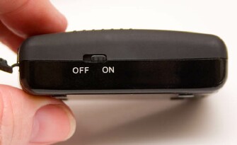
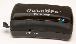
There are two parts to the GPS (short for Global Positioning System) puzzle: a hardware receiver, plus software that takes the received positional information and displays it in a humanly useful manner, such as on a map. Deluos Bluetooth GPS is the hardware part, a small black blob with two LEDs on top, an on/off switch on the side, and a rubber-door-covered charging port on one end. Thoughtfully, the little rubber door is tethered to the device so it wont seek cover in your carpet as soon as you open the box.
As GPSs go, Deluo boasts this weeks technology, according to the companys technical specs (detailed later in this review). Its not limited to working with the included software. It will supply GPS information from the satellites to a variety of programs that run on Palm OS or Windows Treos (and Centro), or laptop computers, or whatever else. Naturally there are gotchas in this equation, which Ill blab about shortly.
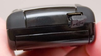
Deluos GPS hooks up over Bluetooth to whatever youre going to use it with, computer or Treo. The only wire is a power supply to recharge its Lithium-ion battery for an eight-or-so-hour shift of doing its thing. The charge takes three hours, but it works while charging, and the package includes a car plug as well as a house plug. My review unit has only a US house current plug.
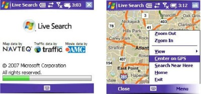
The device comes with Live Search for Windows Mobile, a recently updated offering from Microsoft that nicely interfaces with the GPS signals it gathers from Deluos device via Bluetooth, and generates maps and turn-by-turn directions. Live Searchs claim to fame is its large database of points of interest waypoints or POI in the GPS dialect of TechnoSpeak. These include a mind-bogglingly huge collection of spots for sightseeing, travel destinations, restaurants, shopping haunts, movie houses, hotels, and the like.

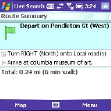
In my travels, Ive often wished for such an easy way to find a place to stay, get my cars alternator replaced (sigh), or feed my face. I checked out the software by giving it a source location that I visit often and know well Atlanta, Georgia. It found most of the cool spots I know about, but didnt find some I thought it should.
To test further, I put in my home address and asked for directions to the citys art museum. No problem. It even created a map with traffic troubles highlighted in orange accurate as far as I could tell. The Atlanta map was solid orange, but thats normal for Atlanta traffic 24-7.
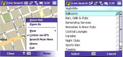
I asked for a list of restaurants in my neighborhood. There are nine within one city block of my apartment, most of which have been in business for a decade or more. Live Search found none of them. Indeed, within a mile it found less than half of the available coffeehouses, and listed some that were more than 90 miles away. Nice places, but not exactly near here as the software claimed. I could find no easy way to set a radius for the search.
Software features

On my Treo 700w, the software works like a dream, with many accommodations of the small screen and the mobile computing environment. For example, once youve searched for a point of interest, a café for example, the software displays not just the street address, but the phone number. You can simply tap the number to call for reservations or to find out if the place is open. When a map or an aerial view is being shown, a simple tap-hold-drag on the Treo stylus scrolls the display. Fast, too. This is way sweet.
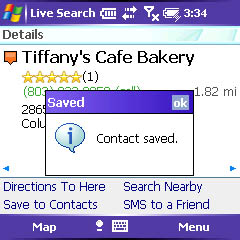
In addition, if you plan to make a found location a frequent stop in your travels whether across town or cross country you can add the place to your contacts lists with a menu option. No need to invoke copy/paste, just select the item from the menu. Fabulous! I quickly built a phone database of some places I like without ever dialing 411.
Sadly, the points of interest database needs substantial updating. Several of the businesses it listed for my neighborhood have moved or gone out of business, and many of the long-standing businesses that it should have brought up were nowhere to be found in the clutches of its database. In this small city, I got less than half of the results Id get by simply consulting the Yellow Pages. My quibble here is with Microsofts database, not with Deluos GPS device. Feed it other software, and the problem might disappear. Or not.
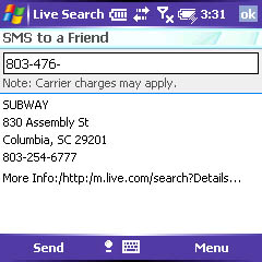
Another quibble. The programs results come up in some order in which I couldnt discern any order. Not alphabetical, and as far as I could tell, not even according to distance from source location. I was not able to find any option to sort differently, either. If there is one, its well hidden from users prying eyes. This problem made finding my favorite Subway restaurant a chore, because in this downtown there are lots of Subways, and I favor the one with the giant free parking lot out back. All of them appeared on the list, but jumbled with the other restaurants and themselves not in any order by distance from me. With the Deluo devices claimed accuracy of two meters (seven feet!) a sort by distance would have been much easier to fathom. There are lots of things I love about this software, but this is one that I dont.
I do like the softwares convenient text-em option. It lets you simply tap to send an SMS message to the phone number thats brought up from the database. Convenient, if the phone youre calling accepts SMSs, but rather useless if its a landline that doesnt. This will probably change eventually. Or landlines will go extinct, and telemarketers couldnt reach me (wish, wish). Either way, we wouldnt have to deal with the problem of un-SMS-able numbers any more.
Usability
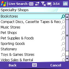
You dont need the GPS unit to use Live Search software. It works with or without the unit turned on. However, the device supplies on-going GPS positional information so the search results you get can be relative to wherever you are, saving the trouble of entering the position.
Indeed, you dont need a Windows-driven Treo, either, if you can provide non-Windows mapping software on the device, Palm OS for example, that you use.
The company claims the unit works on laptops, and it will, using the drivers provided for both Macintosh and PC on the CD that comes in the box. Youll need a Bluetooth enabled computer, whether laptop or desktop, so it can talk to the GPS device. The hitch is that you have to provide software, and although
Windows Live Search is available (free) for laptops, only the mobile version honors the GPS, so its useless for the purpose. Many mapping software packages include support for GPS devices, however. Check yours to see if it honors the NMEA 0132 protocols (for a list of compatible products, see this PDF FAQ file from the companys support website.
One software system that is not compatible is Google Earth. It supports only Magellan and Garmin GPS devices. However, Deluos website lists a shareware software application that interfaces other devices.
Deluo also claims their GPS unit is useful for marine use meaning on your boat for interfacing to an autopilot or other marine electronics device. This is technically true. The GPS delivers its information in the standard NMEA 0183 protocol (v2.2). However, the actuality is that these devices may or may not have the Bluetooth interface the device needs to get its information to them. In addition, the data set is probably going to concentrate usefulness to the western hemisphere. The issue with boats is only the interface to the specific marine electronics. GPS signals are global, courtesy of a cloud of 24 satellites controlled by the U.S. military.
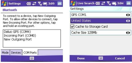
Software setup is mercifully easy, but dont toss out the quick start guide that comes in the box! Its a well crafted documentation for getting the software and the hardware up and running with your WM Treo. Dont forget to set the COM ports baud rate to 4800, too. The techie spec says 9600, but thats wrong. Besides the quick start guide, additional documentation is sorely lacking.
The devices techie specs are:
- Receiver: Tracking up to 12 satellite L1, 1575.42 MHz, C/A code
- Accuracy:
- Position: 2 DRMS approximately 2 m, WAAS support
- Velocity: 0.1 m/s without SA (Selective Availability) imposed
- Time: ±1µs
- Acquisition Time:
- Cold Start: 45 s (Average)
- Warm Start: 35 s (Average)
- Hot Start: 2 s (Minimum)
- Sensitivity:
- Acquisition: -139 dBm
- Tracking: -152 dBm
- Dynamics:
- Max Altitude: 18000 m
- Max Velocity: 500 m/s
- Max Acceleration: ±4g
- Navigation Update Rate: Once per second
- Data Protocol:
- NMMA 0183: GGA, GSV, GSA, RMC
- Coordinate Datum: WGS 84
- Power Consumption: Typical (tracking): 135 mA @ 3.3 V
- Battery/Life (Min): Rechargeable Li-Ion battery: 8 hours
- LED Indicator:
- Red: GPS Status
- Blue: Bluetooth Status
- Green: Charging
- Yellow: Low Power
- Operating Temperature: -20° C ~ 60° C
- Storage Temperature: -30° C ~ 80° C
- Humidity: 5% ~ 95%
- Dimension: 74 x 43 x 21 mm
- Antenna Type: Built-in Patch Antenna
Not much of that means anything to non-techies, so heres what of it is important. The speed of acquisition is how long it takes the unit to figure out from the satellites where you are. In GPS technology, this involves calculating a seven-layer cake of math variables. The unit has to see at least two satellites to provide a two-dimensional position fix. There are plenty, usually, but if theyre behind obstacles on the horizon (or skyscrapers) they might not be accessible. It takes three available satellites to triangulate elevation height above sea level. These days, even in the canyons of a large city, youll probably have plenty of satellite information available. GPS satellite signals are supposedly line of sight, but current devices are so sensitive that you can probably drop the Deluo in your pocket and itll still work almost everywhere on the planet. Note to self: it will not work if you leave it home, so dont forget to pack it.
From a cold start, itll take the unit an average of 45 seconds to get a fix on your position. Once it knows where it is, it has to perform much less math for subsequent fixes, 35 seconds or less, down to a minimum of 2 seconds. While youre moving, it attempts to update its fix once a second thatll make a difference only if youre in a very fast moving vehicle (likely followed by blinking blue lights).
Vertical limitation is 18,000 meters (59,000-odd feet), so the thing will do you no good on the Space Shuttle, although summiting Mt. McKinley wont challenge it much. For velocity, the unit will detect up to 500 meters a second (Mach 1 is only 340), or around 1,100 miles an hour. Ill wait to test this till some kind soul buys me a new Ferrari with rocket engine option.
Next Page: Conclusion >>